3D laser scanning
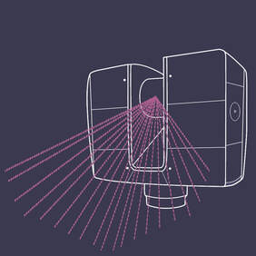
Laser scanning, also known as LiDAR technology, allows to efficiently capture the shape of physical objects using beams of laser light. Cameras continuously record the changing distance and shape of the laser beam while it sweeps along the object or landscape. Light pulses from LiDAR, in combination with GPS or other location data, generate precise, 3D information about the shape and the surface characteristics of objects and buildings. Depending on the sensor used, LiDAR scanning units can fire hundreds of thousands of pulses per second. Each of these pulsed laser measurements, or returns, can be processed into a 3D visualization known as a ‘point cloud’. Examples of 3D models by us and others.
|
Hyperspectral Imaging
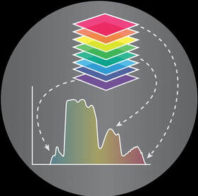
Hyperspectral Imaging is a powerful new technology based on spectroscopy. It collects hundreds of images at different wavelengths for the same spatial area. The collected data form a hyperspectral cube, in which two dimensions represent the spatial coordinates (x,y), while the third coordinate shows wavelength (L). Hyperspectral imaging yields the spectrum for each pixel in the image, making it possible to find objects, identify materials, or detect hidden text or images otherwise invisible to a naked eye using a variety of mathematical algorithms. Additional information about the basics of hyperspectral imaging can be found on wikipedia page or by watching this youtube video.
|
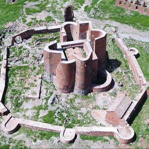
Aerial PhotographyAerial photography (or airborne imagery) refers to the process of taking photographs from an aircraft or other flying objects. The use of latest drones enables to acquire aerial imagery of an amazing quality and aerial photographs remain one of the most reliable and widely used sources of remotely sensed data. High spatial resolution aerial photography enables one to detect and analyze patterns at very fine spatial scales and monitor man-induced changes to the state of the historical sites or analyze long-term effects of the elements. Check this Youtube video of drone-based aerial photography of Armenia.
|
Photogrammetry Photogrammetry is a new technology, which gives an opportunity to create 3D recordings of sites with an extreme exactness. It is based on obtaining reliable information about physical objects and the environment through the process of recording, measuring and interpreting photographic images. Additional information about the basics of photogrammetry can be found here.
|


